Showing posts with label nature inspired. Show all posts

October 5, 2021

The Many Waterfalls of Watkins Glen

Our planet is truly amazing.  The way the forces of nature act on each other.  The way terrain changes over hundreds of thousands of years. Earlier this summer, I wrote about the Shawangunk Mountains that were formed by a massive glacier during an ice age. I recently visited another part of New York impacted by glaciers and 10,000 years of rivers and creeks flowing towards the Finger Lakes of New York. 

Watkins Glen State Park features a 2-mile gorge formed when the last ice age glaciers receded. ‘Glen’ is a Greek word meaning “small, narrow, secluded valley.” The Glen Creek continued to cut away at the sandstone eroding the layers of sandstone and shale that formed 380 million years ago. A series of waterfalls and round flume holes formed amidst the rocks. Beginning in 1863, this secluded valley was opened to the public and started receiving tourist visitors. In 1906 it became New York State property.  During the 1930s, a stone walkway & walls were built by Civilian Conservation Corps. The 1.5 mile Gorge Trail explores nature’s beauty by sending hikers past 19 waterfalls. The highest waterfall, the Central Cascade, plunges more than 60 feet.


We reached Watkins Glen just as Mother Nature called up a thunderstorm dumping huge amounts of rainwater. We stayed in the car for a while and visited the gift shop to let the worst of the storm pass by. Prior to our trip, my parents advised us to “Shuttle up, Hike down.” So glad we had this advice. The upper elevation is 1,000 feet and the trail descends 520 feet to the lower entrance. Once the thunderstorm let up, we headed for the shuttle. As we hiked down, we could see the progression of the water’s erosion (take note of the early pictures compared to the later pictures.) The walls of the gorge were covered in shade-loving lush, green ferns. Water trickled down from the sides of the top of the gorge creating a few extra waterfalls, one of which we had to walk behind as we continued on the trail. The paving stones were wet from the rain, but it is important to note that the trail is normally wet from the falls and mist. Make sure to wear proper footwear.


When visiting, also note that there is a fee per car of $10.  The shuttle is run by a separate company that charges $5 per person, but the fee is worth it!


*All photos taken and owned by me with the exception of the park map

August 10, 2021

Yosemite National Park Hikes

In 2000, I visited Yosemite National Park nestled in the Sierra Nevada Mountains of California.  The park was the destination of a drive across the United States. I spent three days there, camping in a tent overnight, exploring the park’s beauty. The magnitude of Yosemite’s natural beauty left an impression that still exists twenty years later. 

National Park Service logo
The National Park Service was established to oversee federal land set apart and dedicated “as a public park or pleasuring-ground for the benefit and enjoyment of the people." Though the first National Park was established in 1872, it was the Organic Act of 1916 that created a unified National Park System. The Yosemite valley became a popular tourist destination during the California Gold Rush. President Lincoln signed the Yosemite Grant, placing it under the protection of California in 1864. Yosemite became a National Park in 1890. 

Yosemite National Park includes nearly 1,200 square miles of mountainous scenery, waterfalls, and mighty sequoia trees. I approached the park from the west, having stayed in the Pacific Ocean the night before, drive into the valley following the Merced River. The first landmark I saw was El Capitan rising up to my left. It was a truly amazing sight! I could not believe how high, and steep, it was! A climber looked so tiny in comparison. I then drove to the other end of the valley to get a spectacular view of the famous Half Dome rock formation. To hike up Half Dome requires a special permit and 10 to 12 hours of time to hike round trip. I was told the hike begins at 6 am. As exciting as this sounded, I knew I was not up for this challenge. Instead, I took a variety of shorter hikes throughout the park to see its beautiful sites.


El Capitan
Half Dome

The hike that stands out in my memories of Yosemite is that of Sentinel Dome. This granite dome rises to 8,122 feet above sea level. The hike itself is only a 1-mile from the parking area, but the trail has a steep incline with switch-backs working around and up the dome. When I got to the top, I held on to a large boulder while the wind billowed around me in this moment of Zen. I was 3,500 feet above the valley with a bird’s-eye-view. Sentinel rock was off to my right. I could see half-dome from across the valley. 


Yosemite Valley 
Sentinal Rock

This hike is not for those with a fear of heights, and specific hiking shoes are strongly recommended. But the view is magnificent! My photos don’t do it justice. I wish I had taken more photos, but this was before digital photography and I was limited by the number of rolls of film with only 24 photos each.


*Pictures owned by me except the National Parks Service logo.


June 29, 2021

Hiking in the Sky at Minnewaska

In September 2012, I traveled up to Burlington, Vermont to see Magic Hat and Ben & Jerry’s.  While there I did quite a bit of hiking, which I chronicled in my post Hiking Burlington VT, published in September 2017.  On the way back home, I made a few stops in Massachusetts and New York.  A friend and avid hiker recommended I stop in the Shawangunk Mountains, also known as “The Gunks.”  After doing some research, I decided to visit the Minnewaska State Park Preserve located on a ridge of “The Gunks.”  I am so glad I made that stop.

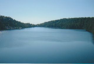
                         Lake Minnewaska
I parked my car in the Upper Parking Area (see park map below) right on Lake Minnewaska, a sky lake with pristine, clear water.  “The Gunks” were formed during an ice age that lasted from about 110,000 to 12,000 years ago. Glaciers had moved down from Canada, gouging out softer rock along the way.  The rocky outcroppings left behind are made of "quartz and more quartz" conglomerates and sandstones.

I decided to take the hike out to Gertrude’s Nose. Hikers can follow a looping trail that is about 7.5 miles in length.  The trail starts off sharing the Lake Minnewaska and Millbrook Mountain carriage roads.  The Gertrude’s Nose trail breaks off as a footpath about a quarter-mile from Patterson's Pellet, a large boulder left by a receding glacier. 

        
I experienced a difficult section where I climbed down a rocky crevasse, then back up the other side. After reaching Gertrude's Nose, I chose to hike back the same way I came, which was about 6 miles total.

With the sun shining on my face, I hiked along the cliff's edge, 1200 feet high overlooking Palmaghatt Ravine and Palmaghatt Kill. The rush of being on the edge was amazing. As I looked out over the surrounding mountain range and valleys, I felt close to heaven. When I reached Gertrude's Nose, I sat on a boulder, ate my granola bar, and meditated on the amazingness of nature, creation, & our part in it.


I definitely recommend this hike to anyone traveling in Southern New York State. Minnewaska State Park Preserve opens daily at 9:00 am year-round. Closing hours are posted at the Park Preserve entrance and are adjusted seasonally. There is a small fee of $10 per car.


Minnewaska State Park Preserve Map

*All photos taken and owned by me with the exception of the Park Preserve map

November 10, 2020

A Hike Along Lake Redman

Pennsylvania is a beautiful state.  That beauty is often overlooked.  When people think of PA, they think of its many pro-sports teams, the city of Philly and the Liberty Bell, and the Amish.  Pennsylvania has over 100 State Parks making it one of the Top 10 States With the Most State Parks.  York County alone has 11 county parks.  One of those county parks, William H Kain County Park, surrounds the local reservoirs: Lake Redman and Lake Williams. 


This park has been there since 1976, two years before my parents and I moved to Pennsylvania.  It is one of those places that has always been there.  The property is part of a lease agreement between York County and The York Water Company.  The two lakes are divided by the Lake Williams/York Water Company Dam along South George Street, also known as the Old Trail, the Susquehanna Trail, or Rt 111.  This is the old highway that connects Baltimore, MD and Harrisburg, PA.  


Seven different labeled hiking trails surround both reservoirs.  The trails are also open to bicycling and horseback riding.  During fishing season, the lakes are surrounded by local fishermen.  I went for a hike the Saturday of Labor Day weekend, and the lake shores will filling up with people of all generations casting out their fishing line. There is also a boat launch as well as rentals available (although rentals were not available in 2020 due to COVID.)  Lastly, there are picnic tables at each parking area, so feel free to pack something to eat while you relax after the hike.  


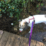
The trailhead for the hike I’m featuring is at the Lake Redman Activity Area off of Hess Farm Rd.  According to the map, it is 1.4 miles with some small hills.  It is an out and back again type trail that turns around near the dam.  The views of Lake Redman are excellent, with parts of Interstate-83 visible.  While hiking this, you pass under the iconic Lake Redman sign visible from the highway. It is both dog & kid-friendly, though you’ll want to remember to use bug spray depending on the time of year.  The trail is mostly shaded by a variety of deciduous trees. The terrain is a mix of mown grass and gravely dirt. At one point, there is a small wooden bridge (more like a boardwalk) over a natural stream. On the way back, my dog stepped in for a little drink.


Minor cautions: Goose and deer hunting are allowed at certain times. I always recommend wearing a bright color when hiking, no matter what time of year. When hiking during the summer, be aware of poison ivy, which loves this mid-Atlantic state. I also recommend checking for ticks after your outing.


*All photos taken and owned by me. Map source: yorkcountypa.gov.


September 22, 2020

Pinnacle Overlook & Fire Line Trail Hike

Designated as a National Recreation Trail by the US Department of Interior, this 139 acre nature preserve is managed by the PA Department of Conservation and Natural Resources (PA DCNR). The hiking trails are part of the Kelly’s Run - Pinnacle Trail System in Holtwood, PA.  The land that makes up the Pinnacle Scenic Overlook Nature Preserve was donated by PPL Holtwood, LLC.  The Conestoga Trail overlaps and runs concurrently with parts of the Kelly’s Run Trail.  


I enjoy the Pinnacle Overlook vista point. The view of the Susquehanna is stunning!  The overlook along with day-use facilities is accessible from the visitor parking area.  Be aware that this access is closed from October to April, and hunting is allowed during those months. This stretch of the Susquehanna River is just north of the Holtwood Dam and gets quite wide.  Two islands poke up out of the water here: Duncan Island & Reed Island. The river valley is surrounded by rolling hills on both the Lancaster County and York County sides.  


From the main overlook spot, I hiked along the river on the Fire Line Trail. 
I took my dog, Rissy, with me on this hike and she loved it.  On this trail, I found a more private spot to sit on a rock outcropping where I had a snack and watched the river from up high.


This trail is marked with yellow blazes. At approximately .75 mile, it intersects with the Pinnacle Trail.  Bear left and follow the alternating yellow and white blazes for approximately .25 mile back to the day-use area.  It’s difficult to be exact with the distance based on the map I have (see below), but it is definitely no more than 1 mile.  This link offers more details about trail milage: MidatlanticHikes.com.


To get to Pinnacle Overlook from Columbia, PA, drive 40 minutes south on River Rd past Washington Boro, through Safe Harbor & Martic Forge, then past Tucquan Glen Nature Preserve to Pinnacle Rd.  Other notable nature spots in the area are the Tucquan Glen Nature Preserve, Lock 12 Recreation Area (the old lock is still there to see!) and Muddy Run Park. 


*All photos taken and owned by me

August 11, 2020

Inspiration From Gardens & Flowers


I love flowers and gardens.  The women in my family are influencers who shared their love of flowers with me.  My earliest memories are me with my Grandmom Fleischmann planting zinnias in her flower beds.  She always got market packs of bright colors.  My Grandmom Winter had gardens around her house full of black-eyed-susans and roses.  And then there’s my Mom, who filled our yard with daisies, chrysanthemums, tulips, and azaleas, to name a few.  


When I was in high school, I got to have my own section of garden to plant flowers.  I filled it with wildflower seeds, then watched as echinacea, calendulas, and cornflowers grew and bloomed.  I took photos with my compact camera, though grainy and not the best balanced composition, it was my start.


Then
Now

The digital camera had a huge impact on my photography.  No longer waiting until the roll of film was finished to send off for development, then opening the package to see if the photographs turned out or not.  With the larger display screen versus the tiny viewing window, it became easier to balance the composition.  I took photos of flowers, vegetables, and nature trails.  I captured images of butterflies and caterpillars.  I took my flash drive to my favorite one-hour printer (unfortunately no longer there.) Prints fill my photo albums.  


It was around this same time that I started painting flowers.  I always loved art in school and had even considered becoming an art teacher.  At first, I focused on daisies and coneflowers.  When I wanted to paint crocuses, I took a picture and made sketches.  The same with pansies, then lilies.  If I didn’t have my own picture, I searched online for images from which to draw.  


With the advent of camera phones, I now have a way of sharing my photographs of flowers and nature with other people.  When visiting my parents, I wander around their yard taking pictures.  My Mom has filled the gardens with a wide variety of perennials, surrounded by groundcovers like periwinkle and flox.  She has indigo clematis, orange butterfly weed, and black-eyed-susans (a reminder of my parents’ home state of Maryland.)  Some of my wildflowers are still there in my old section of the garden with mums and daisies mixed in now.  


Nature continues to be a major inspiration in my life; whether I am hiking in the woods or reading in the backyard beside the gardens.  I love having the ability to share my photos and share my inspiration.  With so many social media options and the adverse effects that social media can have on us, I have chosen to focus on one format, Instagram.  My handle is @snowywindgrams.  


*All photos taken and owned by me